Koordinaten Vermessung
Advertisement
XSIGNO v.0.6.0
XSIGNO is an entry-level solution to photogrammetry. A photo-measurement program to determine 3D coordinates and distances from a collection of digital photographs.A measurement is done by taking pictures from changing views of a measurement object.
AllTrans
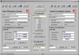
AllTrans can be used for world wide professional coordinate transformations between international and national coordinate systems with or without geodetic datum change. Transformations between State-Plane-Coordinates (NAD83, NAD27, Transverse Mercator,
Advertisement
EASY-ROB DEMO v.5.602
EASY-ROB™ is a planning and simulation software for manufacturing plants with robot work cells.With EASY-ROB™ you plan and verify your robot work cells on your PC.
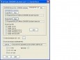
AllTrans EGM2008 calculator v.1 2
AllTrans EGM2008 calculator can be used to calculate EGM2008 geoid undulations in a quick and easy way. Manual input, file input and geoid grid calculation. It is possible to modify the MSL heights and the geoid undulations in NMEA GGA

AutoFinder v.1.0.0.0
Nur 2 Clicks um Auto und Freunde zu finden. 1 Click zeigt Ihnen den Standort Ihres Fahrzeugs und den Weg dahin. SMS und e-Mail mit Ihrem Standort und dem Standort Ihres Fahrzeugs. Energie-optimiert, damit Ihr Akku lange hält. Sprachen: english,

Notruf v.1.0.0.0
Mit diesem Notfall/Notruf Programm haben Sie alle wichtigen Telefonnummern griffbereit und es sollte auf keinem Smartphone fehlen. Weiterhin enthalten sind internationale Rufummern, Speichermöglichkeit von Medikamenten, Blutgruppe,
Geodaten Deutschland v.18.01
The database contain geodata of the Federal Republic of Germany with geo referenced towns, municipalities, town quarters, administrative units, postal codes, telephone preselections, nature areas, landscapes, climatic zones for proximity searches ec.
Geodaten International v.6.01
Geodata International - World-wide database of countries with georeferenced towns, municipalities, postal codes and administrative units with WGS84 and UTM coordinates and elevations for geocoding, proximity search, navigation, distance calculation.